Tlalnexpan (CmpRG)
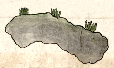
This is a simplex glyph naming the community called Tlalnexpan. It is featured in the 1580 Relación Geográfica de Cempoala (originally Cempohuallan, and now Zempoala, Hidalgo). The glyph consists of a large, irregular figure outlined in black and filled with gray paint. Three green maguey plants are placed along the upper side of the figure. In this way, it resembles some of the larger, naturalistic hills found elsewhere on the map. However, in this case the glyph may not depict any kind of hill or elevation. The place name is made up of the word tlalnextli, which means “dust,” and the locative -pan, “on, at, with,” etc. Tlalnextli itself is a combination of tlalli, which can mean "land, earth, or dirt” and nextli, “ash,” giving “dirt-ash” or in other words “dust.” It is likely, then, that what the artist who drew the glyph had in mind was to show the area of dusty and presumably rather dry and sterile land that gave the nearby town its name. The gray shape may provide a semantic indicator for the locative -pan.
Robert Haskett
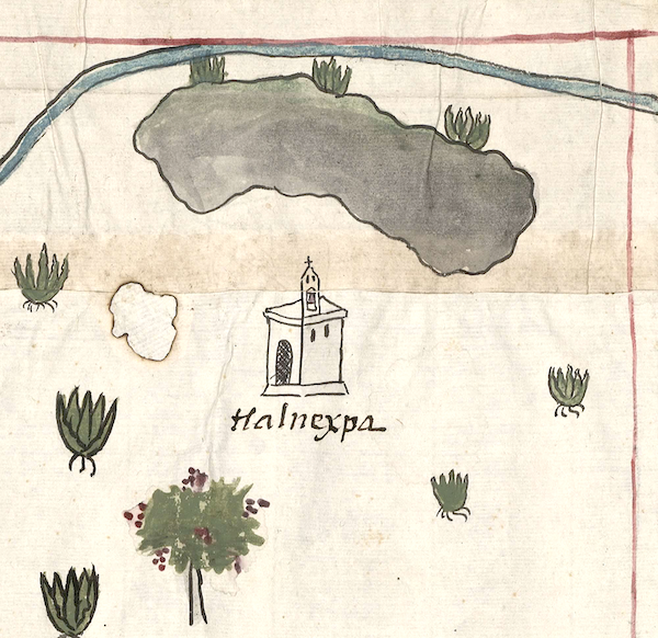
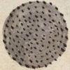
Another word for dust is teuhtli, and an example appears below. That dust term seems more tied to visual whirlwinds. Tlalnexpan was a sujeto (subject communities) of one of the four Cempohuallan cabeceras (head towns), Tecpilpan. As with other named places on the map, the glyph is associated with the image of a church, a semantic indicator of an inhabited place, as well as an alphabetic gloss of the town’s name (see the historical contextualizing image). The inhospitable terrain suggested by the place name may have been softened and made habitable by a canal, pictured on the map as a stretch of blue bordered by black lines, passing near to the dusty area (see the historical contextualizing image). For more information about the RG map, see Biblioteca Digital Mexicana, A.C., http://bdmx.mx/documento/mapas-relaciones-geograficas-cempoala-epazoyuca... Mundy, Barbara E., “Mapping Babel: A Sixteenth-Century Indigenous Map from Mexico,” The Appendix, 1:4 (October 2013), Mundy (1996), and Ballesteros García (2005).
Robert Haskett
tlalnexpa
Tlalnexpan
Robert Haskett
1580
Robert Haskett
dust, polvo, lands, tierras

tlalnex(tli), dust, https://nahuatl.wired-humanities.org/content/tlalnextli
tlal(li), dirt, soil, dust, https://nahuatl.wired-humanities.org/content/tlalli
nex(tli), ash, https://nahuatl.wired-humanities.org/content/nextli
-pan, on, at, with, https://nahuatl.wired-humanities.org/content/pan
la tierra polvoroso
Robert Haskett
Relación de Cempoala - University of Texas Libraries Collections. 1580-11-01. https://collections.lib.utexas.edu/catalog/utblac:f87917e2-e3c9-4eb2-a83...
Materials that are in the public domain (such as most of the maps in the PCL Map Collection) are not copyrighted, and no permission is needed to copy them. You may download them and use them as you wish. The image appears here courtesy of the University of Texas Libraries, The University of Texas at Austin. If you do publish anything from this database, please cite the Visual Lexicon of Aztec Hieroglyphs.


