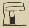
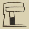
chantli (CholRG)
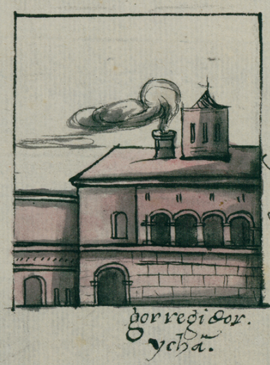
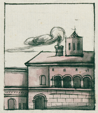
This painting of the iconographic example of the home (chantli) of the corregidor (a Spanish colonial official) shows a very large European-style house with smoke coming out of a chimney. Next to the chimney, there is a small tower on the roof. The house has two lower floors. The second floor has a row of arches with an outdoor balcony. The ground floor appears to be built of large stone blocks and has two arched entrances.
Stephanie Wood
This is a window onto the kinds of wealth the colonial officials obtained and manifested, even within an Indigenous community. For comparison, see (below) the chantli that was occupied by an Indigenous person of the elite.
Juan José Batalla points out how a curving arched doorway, sometimes called tecololli in Nahuatl (and notes how perhaps tolcalli would be more appropriate), is a European architectural introduction. See: "Análisis de elementos gráficos de contenido occidental en los glifos de los códices coloniales del Centro de México: el caso de los antropónimos nahuas," in El arte de escribir. El Centro de México: del Posclásico al siglo XVII, eds. Juan José Batalla Rosado and Miguel Ángel Ruz Barrio (Zinacantepec, Estado de México: El Colegio Mexiquense, A. C., 2018), 84.]
Stephanie Wood
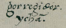
gorregidor
ychā
corregidor ichan
Stephanie Wood
1581
Jeff Haskett-Wood
casas, casonas, corregidores, colonialismo
chan(tli), home, https://nahuatl.wired-humanities.org/content/chantli
hogar
Stephanie Wood
https://collections.lib.utexas.edu/catalog/utblac:bfe9df59-d0c1-46a6-8c4...
This map (original: 31 x 44 cm.) of Cholollan (modern spelling: Cholula), from 1581 and housed in the Benson Library at the University of Texas, Austin, which considers it to be in the public domain. It is an indigenous-authored map that was made in response to questionnaires from the Spanish crown about its colonial possessions. Responses to the questionnaires were called Relaciones Geográficas (RG). The map’s glosses are in Nahuatl and Spanish, and the style is mixed indigenous-European. This is an urban plan of the heart of Cholula, emphasizing a grid pattern, which was of special interest to the colonizers. Several altepetl (Nahua socio-political units) are encompassed by the map, although they are called “cabezeras” (cabeceras, Spanish for head town) on the map. San Gabriel is the principal church of the many churches shown. The market square, “tianquizco,” holds a prominent, central place. A fountain occupies this space.
The Benson Library has determined that this pictorial manuscript is in the public domain and is shared through Creative Commons. The library kindly provided this image for inclusion in the Mapas Project, a digital collection of indigenous-authored pictorial manuscripts (soon to be archived) once at the University of Oregon. Student assistant Ellen Heenan processed the images using PhotoShop in 2015, and Stephanie Wood has repurposed these images for use in the Visual Lexicon in 2024.