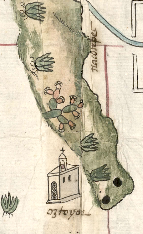
Oztoyocan (CmpRG)
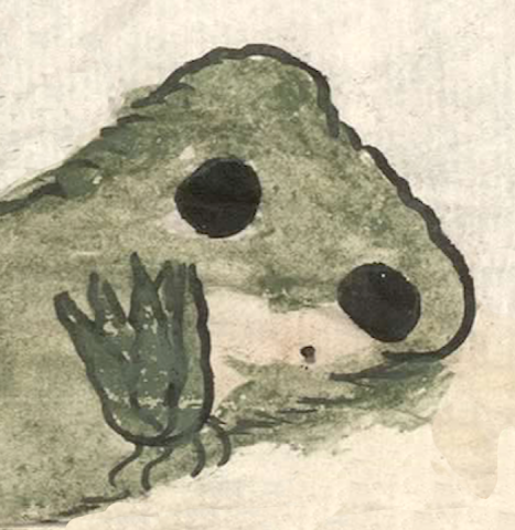
This is a compound glyph for the toponym Oztoyocan. It appears on the map included with the 1580 Relación Geográfica de Cempoala (Hidalgo). The name consists of “caves” (oztotl), [-yotl) ("having the nature of"), and the locative -can ("place of"). The caves are represented by two solid black circles on the flanks of a naturalistic hill. Next to the caves is a maguey plant showing its roots, undoubtedly a semantic indicator for the flora found at the site. The hill is an elongated feature shaded mostly in green with some tan. At its other end is a hill-like feature rising from it, and it is glossed as Tlacotepec (“on/at half mountain;” see the historical contextualizing image).
Robert Haskett
On the map a seam resulting from joining two sheets of paper together runs through the alphabetic gloss, eliminating the "yoc" and a bit of the "a" parts of "yocan" (see Gloss, below). Oztoyocan is an inhabited place, a status established by the semantic indicator of a black-and-white drawing of a church structure. This church appears to the right of the simplex glyph and above the alphabetic gloss (see below and the historical contextualizing image). Barbara Mundy mentions an extancia called Otzoyuca that was a subordinate community to the cabecera of Epazoyuca (see the citation, below). The magueyes and a large rendition of a prickly pear cactus rising near the site not only serve as semantic indicators of the arid landscape and its flora, but most likely for the ubiquity of the agave plant in Zempoala, which is in turn related to a growing commercial pulque manufacture in the region (see Gerhard, Historical Geography of New Spain, 67-68). The simple black circles standing for oztotl on the map are a far cry from the elaborate representations of caves found in the Codex Mendoza (see below). The streamlined, simplified rendition of caves as black holes in the earth found on the map is probably a result of Spanish cultural influence that had been spreading into the Nahua world over the course of the sixteenth century. For more information about the Relación, see Mundy, Barbara E., “Mapping Babel: A Sixteenth-Century Indigenous Map from Mexico,” The Appendix, 1:4 (October 2013), Mundy (1996), 129, and Ballesteros García (2005), 63.
Robert Haskett and Stephanie Wood.
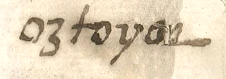
oztoyo[can]
Oztoyocan
Robert Haskett
1580
Robert Haskett
We are counting the hill and the caves as two elements. The caves are the most glyph-like of these elements--even as they are much changed from earlier cave signs. The hill serves as a semantic locative. The maguey is only incidental.
The caves are the primary element to be "read" in this compound, with the hill and the agave added for semantic value.
caves, caverns, cuevas, cavernas, nombres de lugares
ozto(tl), a cave, a cavity; also a metaphor for the womb, https://nahuatl.wired-humanities.org/content/oztotl
-yocan, place where there is a lot of (the preceding noun), https://nahuatl.wired-humanities.org/content/yocan
-yotl, having the nature of; an abstract or collective nominal suffix that, when possessed, expresses inalienable or organic possession of the noun, https://nahuatl.wired-humanities.org/content/yotl
-can, place of, https://nahuatl.wired-humanities.org/content/can-2
cuevas
Robert Haskett
Relación de Cempoala - University of Texas Libraries Collections. 1580-11-01. https://collections.lib.utexas.edu/catalog/utblac:f87917e2-e3c9-4eb2-a83...
Materials that are in the public domain (such as most of the maps in the PCL Map Collection) are not copyrighted, and no permission is needed to copy them. You may download them and use them as you wish. The image appears here courtesy of the University of Texas Libraries, The University of Texas at Austin. If you do publish anything from this database, please cite the Visual Lexicon of Aztec Hieroglyphs.