tecpan (ColRG)
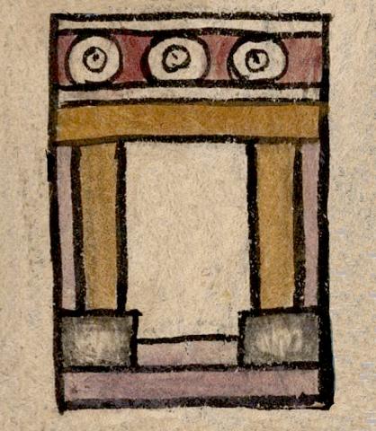
This is an iconogram appears to be an important municipal building or palace (tec(pan) located in the heart of the Valley of Mexico town of Colhuacan (also spelled Culhuacan). It appears on the map of the Relación Geográfica de Culhuacan dating from 1580. The multi-colored, black-outlined structure appears in frontal view. Its doorway is flanked by two columns colored in brown resting on rectangular gray bases. The columns support a lintel, also colored in brown. Above this is an element consisting of two horizontal parallel bars with three concentric circles in a red field between them. The base of the structure boasts two black-outlined bars with colored in lavender (as are the side walls), the short appearing between the two column bases (suggesting a step or threshold), and a longer one beneath this that may be the building’s foundation or a platform upon which the whole thing rests.
Robert Haskett
We have suggested tepan as the meaning of this logogram because the element with the three circles running along its roof line is characteristic of royal palaces or important buildings associated with local government. However, it could have been known instead as either a tepancalli or (perhaps more rarely) a tepanchan. There is a gloss written inside the doorway (see the gloss and the historical contextualizing image, below) that reads comunidad, which in Spanish would refer to a casa de comunidad. Such a structure was indeed was an important building associated with local government, a government palace. A Nahua who spoke Spanish might have seen the iconogram of the structure as the “casa” part of “casa de comunidad,” in fact. The building is situated just below the compound glyph for Colhuacan. The pair are situated in the center of the map and are bordered on three sides by roads featuring black human footprints. A waterway with two wooden bridges running across it borders part of the right wall of the building, while another waterway flows at an angle above them. Three churches are depicted nearby (see the historical contextualizing image). For more information about the Relación and its map, see Mundy (1996), Steinhilper (2009), and Acuña (1986).
Robert Haskett
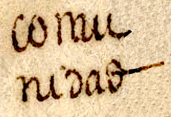
comu
nidad
comunidad
Robert Haskett
1580
Robert Haskett
palaces, palacios, houses, casas, municipal buildings, casas de comunidad
tec(pan), government building, royal palace, https://nahuatl.wired-humanities.org/content/tecpan
tecpancal(li), royal home, palace, community house, https://nahuatl.wired-humanities.org/content/tecpancalli
tecpanchan, government palace, https://nahuatl.wired-humanities.org/content/tecpanchan
casa de comunidad, palacio de comunidad
Robert Haskett
Relación de Culhuacan – University of Texas Libraries Collections, 1580-11-15. https://collections.lib.utexas.edu/catalog/utblac:740d6d5b-280a-45f4-a3b...
Materials that are in the public domain (such as most of the maps in the PCL Map Collection) are not copyrighted, and no permission is needed to copy them. You may download them and use them as you wish. The image appears here courtesy of the University of Texas Libraries, The University of Texas at Austin. If you do publish anything from this database, please cite the Visual Lexicon of Aztec Hieroglyphs.