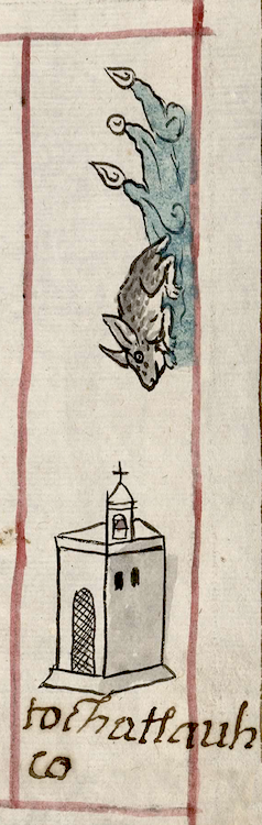
Tochatlauhco (CmpRG)
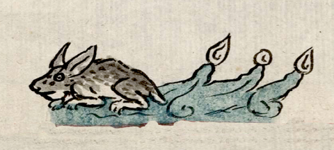
This compound place glyph names the Indigenous community of Tochatlauhco ("Rabbit Gorge"). It appears on the map accompanying the 1580 Relación Geográfica de Cempoala (Hidalgo). The glyph consists of a rabbit (tochtli) on top of a stream or river of running water (atlauhtli) (probably through a gorge). The locative -co is not visualized, unless the water implies a location, such as a ravine. The elements of the glyph are outlined in black. The tochtli, shown in a crouching position facing left, is partially shaded in brown with black spots. Its pointed ears are standing up and tilted to the right towards its back. The atlauhtli is a stream of swirling water painted in turquoise blue and given the black lines to show current and flow. One droplet (or precious gem) and two turbinate shells, all of them uncolored, appear at the end of each of three projecting elements. The water flows to the viewer's right. The rabbit is facing or pointed toward a church, outlined in black, just above the alphabetic gloss (see the historical contextualizing image and gloss). This building appears to be serving as a semantic element emphasizing that the glyph is naming an inhabited place rather than simply a landscape feature.
Robert Haskett
Tochatlauhco was a subject community of Epazoyuca, a cabecera (head town) located near to Cempoala and depicted by its own glyph and gloss on the map. Aside from the possible semantic element of the church mentioned, above, this glyph shows little obvious Spanish influence. It appears in a red-outlined rectangular box, the last one on the right of the group of these elements. If there were no church structure, it might be possible to define it as the name of a plot of agricultural land, but the presence of the Catholic structure suggests otherwise (see the historical contextualizing image). Indeed, the Spanish text of the Relación emphasizes that all of Cempoala’s dependent communities have churches, something Barbara Mundy has also noticed. The water element as well as the place name intimate that there is indeed some kind of body of water in or near the community. For a study of the RG, see Mundy, Barbara E., “Mapping Babel: A Sixteenth-Century Indigenous Map from Mexico,” The Appendix, 1:4 (October 2013), the same author's book, The Mapping of New Spain (1996), particularly pg. 139, Figure 59, and Ballesteros García (2005), 53-54, figure 8.
Robert Haskett
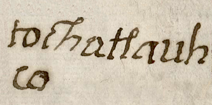
tochaltlauh
co
Tochatlauhco
Robert Haskett
1580
Robert Haskett
place glyphs, topónimo, pueblo, rabbits, conejo, rivers, streams, rios, water, agua, nombres de lugares
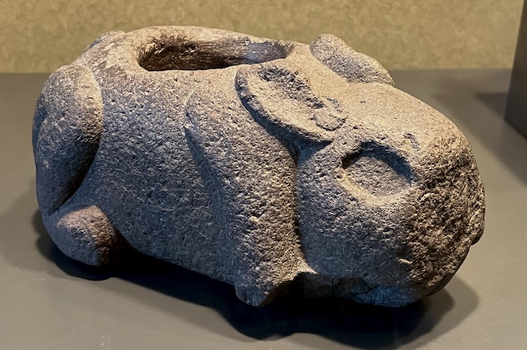
Carved stone pulque container in the shape of a rabbit, Museo Nacional de Antropología e Histroria, Mexico City, 14 February 2023. Photo by Stephanie Wood, commentary by Robert Haskett.
toch(tli), rabbit, https://nahuatl.wired-humanities.org/content/tochtli
atlauh(tli), river canyon or gorge, https://nahuatl.wired-humanities.org/content/atlauhtli
a(tl), water, https://nahuatl.wired-humanities.org/content/atl
El Barranco del Conejo
Stephanie Wood
Relación de Cempoala - University of Texas Libraries Collections. 1580-11-01. https://collections.lib.utexas.edu/catalog/utblac:f87917e2-e3c9-4eb2-a83...
Materials that are in the public domain (such as most of the maps in the PCL Map Collection), are not copyrighted and no permission is needed to copy them. You may download them and use them as you wish. The image appears here courtesy of the University of Texas Libraries, The University of Texas at Austin.