
Colhuacan (ColRG)
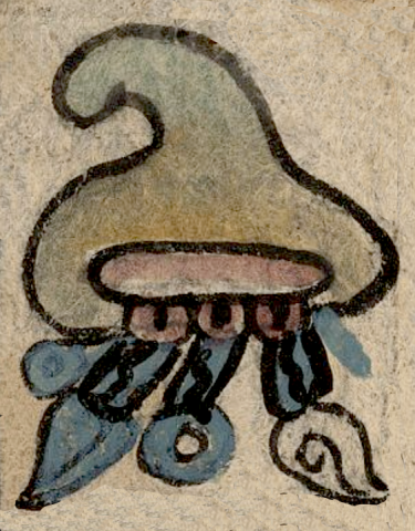
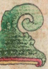
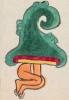
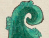
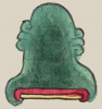
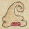
This is a compound glyph naming the Valley of Mexico town of Colhuacan (also spelled Culhuacan, perhaps "Place of the Colhua"). It appears on the map of the Relación Geográfica de Culhuacan dating from 1580. The glyph consists of a tepetl) (hill or mountain) with a curved summit. This element is outlined in black with green and brown coloring within. At its base the hill has a red-colored bar with rounded ends, a version of elements found on older, more traditional renditions of such things (see below) as the site where a natural spring would emerge. Three red-colored circular elements with black dots in their centers are depicted along the base of this red bar. A water sign consisting of several blue-colored prongs flows out of the base of the glyph. Two of the prongs are tipped with round droplets (or precious gems) and two with turbinate shells, one of which is blue, the other uncolored but sporting a curled black line in its interior. Following Barbara Mundy (1996), 142, the place name Culhuacan consists of colli, “curved,” the possessor suffix -hua, and the locative -can, “place of.” This has been analyzed in various ways (e.g., Barbara Mundy suggests “Place of the Culhua,” as does René Acuña [1986],note 4, pg. 32), but a literal translation would be “place of the curved hill/peak.” Neither the possessive suffix nor the locative are show visually in the glyph, although the tepetl itself probably is a semantic indicator of “place.”
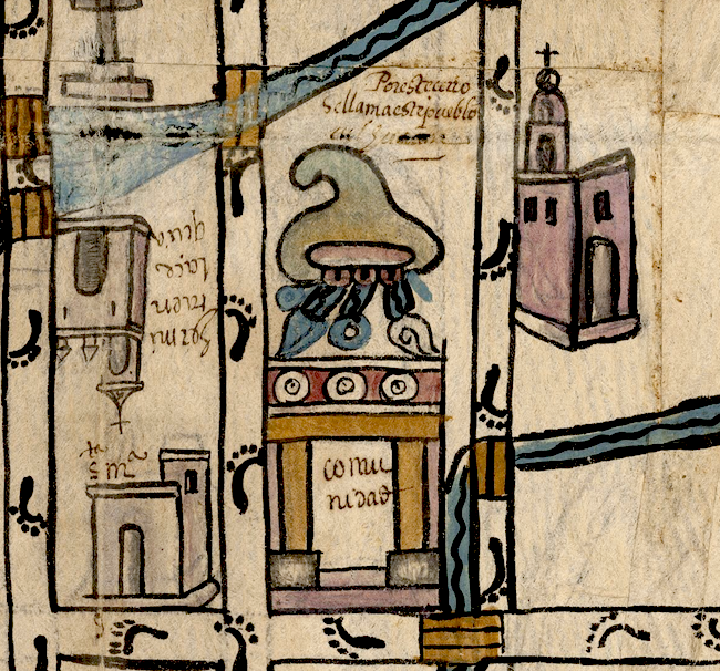
Robert Haskett
The compound place glyph is placed centrally on the map and rests just above a rendition of a tecpan-like building (palace, municipal building) which may also double with the hill glyph to indicate an inhabited place (see the historical contextualizing image). As far as the exact meaning of all the elements of the place glyph itself are concerned, the roles played by the water and circular elements below the red bar remain unclear. As to the water symbol, the Spanish-language text of the Relación refers to watery elements in several of its entries, mentioning the existence of springs, irrigation canals, and the like, in various locations. The map itself features waterways and one large, blue element that may stand for a spring, a 'large [water] tank,'" or "a fountain called 'del Estrella'" whose waters were taken to Mexico City because "it is the best that exists in the realm" (Acuña, 1986,34). It is possible, then, that the water element at the base of the place glyph gives semantic emphasis to the ample water sources in the area, including, perhaps, a spring located on or near the hill that gave the town its name. The three, round, red elements projecting below the red bar at the base of the hill are even more difficult to identify. Article 9 found in this Visual Lexicon, “Red and Yellow Interiors,” suggests that water might have been thought as the “blood of the earth” issuing from the underworld. The color red at the base of tepetl glyph may be an indicator of the portal, in the form of lips and mouth, of the “body” of the earth, the place for the passage of liquids. The three red circular elements, then, might represent droops of blood coming from this mouth.
Yet the compound glyph has another meaning that is not alphabetically glossed on the map or in the Relación’s Spanish text. On this level, the figure of the hill with the water issuing from its base act phonetically. The water, atl) provides the “a-,“ and the hill, tepetl), provides the rest of the word for altepetl), or “city-province,” the term for a major polity and its region that Spaniards later translated as cabecera (head town). Thus the compound glyph on the map becomes a sentence declaring “This is the altepetl of Colhuacan.” The atl tepetl serves as a visual diphrasis. A similar diphrase appears in the Codex Osuna.
For those interested in another study of the Relación Geográfica de Culhuacan, aside from Mundy’s work see Steinhilper (2009).
Robert Haskett
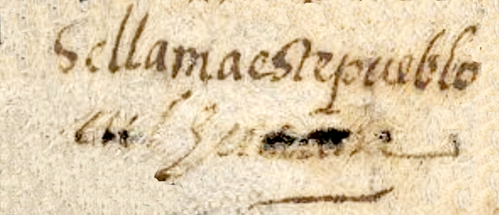
Se llama este pueblo culhuacan
Colhuacan
Robert Haskett
1580
Robert Haskett
We are counting the curved peak of the hill, the hill itself, the water, and the possible teeth as the four elements of this compound glyph.
curves, curvas, hills, mountains, cerros, montañas, curvado, torcido, nombres de lugares, topónimos, place names
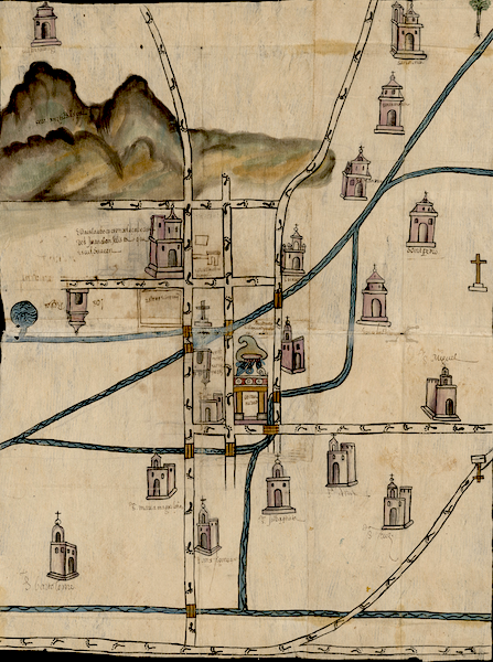
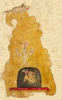
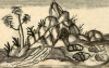
This is the full map, with the place glyph in its very center.
col(li), something bent, curved, https://nahuatl.wired-humanities.org/content/colli-1
-hua, possessor suffix, https://nahuatl.wired-humanities.org/content/hua
-can, place of, https://nahuatl.wired-humanities.org/content/can-2
Lugar de la Montaña Torcida, o el Pico Torcido
Stephanie Wood
Relación de Culhuacan – University of Texas Libraries Collections, 1580-11-15. https://collections.lib.utexas.edu/catalog/utblac:740d6d5b-280a-45f4-a3b...
Materials that are in the public domain (such as most of the maps in the PCL Map Collection) are not copyrighted, and no permission is needed to copy them. You may download them and use them as you wish. The image appears here courtesy of the University of Texas Libraries, The University of Texas at Austin. If you do publish anything from this database, please cite the Visual Lexicon of Aztec Hieroglyphs.
