Oztotlatlauhcan (CmpRG)
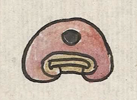
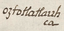
This compound glyph stands for Oztotlatlauhcan, the name of a community that appears on the 1580 Relación Geográfica de Cempoala (Cempohuallan, or Zempoala, Hidalgo, today). It consists of a circle filled-in with black, representing a cave (oztotl) superimposed near the peak of a somewhat flattened red hill/mountain. The color red, (tlatlauhqui), is the second element in the place name. The hill or mountain (tepetl) acts as a semantic indicator of place, serving in this way as the otherwise unvisualized locative -can, “place of.” The tepetl is a bit nonstandard, in that its black-outlined form is squat rather than the more usual bell shape, and because it is red. The three brown-washed lines at its base, the outer one curling in at each end, would more normally be colored in red, but it would seem in this case, that the red hill itself mandated a contrasting color of some kind. That said, yellow is another customary color for the horizontal lines at the base of a tepetl.
Robert Haskett
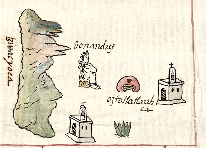
On the map, Oztotlatlauhcan is situated next to a small church (see the historical contextualizing image). On this manuscript, churches act as semantic indictors of inhabited places. The church is stylistically typical of the map in that it shows some perspective in its composition, with the structure shown at a bit of an angle that allows two of its four walls to be visible--one with a door, the other with two small arched black windows. Its arched doorway has a kind of lattice-work filling in black. A small bell tower projects upwards above the wall with the two windows. The apex of its arched form boasts a cross, and there is a bell, colored brown (probably to mimic bronze or brass), in an arched opening. All of this betrays Spanish cultural influence in the artist’s work. For more information about the map, see Biblioteca Digital Mexicana, A.C., http://bdmx.mx/documento/mapas-relaciones-geograficas-cempoala-epazoyuca... Mundy, Barbara E., “Mapping Babel: A Sixteenth-Century Indigenous Map from Mexico,” The Appendix, 1:4 (October 2013), and the same author’s book, The Mapping of New Spain: Indigenous Cartography and the Maps of the Relaciones Geográficas (Chicago and London: The University of Chicago Press, 1996).
Robert Haskett
oztotlatlauh
ca
Oztotlatlauhcan
Robert Haskett
1580
Robert Haskett
caves, cuevas, caverns, cavernas, red, rojo, hills, mountains, cerros, churches, iglesias, nombres de lugares

ozto(tl), cave, cavern, https://nahuatl.wired-humanities.org/content/oztotl
tlatlauh(qui), red , https://nahuatl.wired-humanities.org/content/tlatlauhqui
tepe(tl), hill, mountain, https://nahuatl.wired-humanities.org/content/tepetl
-can, place of, https://nahuatl.wired-humanities.org/content/can-2
la cueva roja, la caverna roja
Robert Haskett
Relación de Cempoala - University of Texas Libraries Collections. 1580-11-01. https://collections.lib.utexas.edu/catalog/utblac:f87917e2-e3c9-4eb2-a83...
Materials that are in the public domain (such as most of the maps in the PCL Map Collection) are not copyrighted, and no permission is needed to copy them. You may download them and use them as you wish. The image appears here courtesy of the University of Texas Libraries, The University of Texas at Austin. If you do publish anything from this database, please also cite the Visual Lexicon of Aztec Hieroglyphs.


