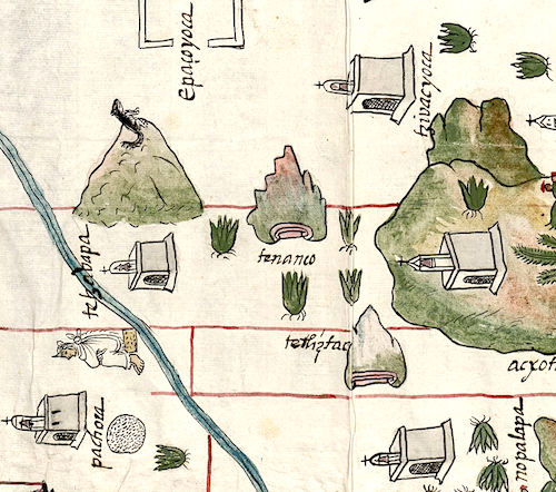
Tenanco (CmpRG)
This is compound glyph stands for Tenanco ("At the Wall," the name of a landscape feature that appears on the 1580 Relación Geográfica de Cempoala (Cempohuallan, or Zempoala, Hidalgo, today). The glyph consists of two merged elements. Its basis is a slightly naturalized tepetl) (hill/mountain) with spiky elements rising up from it on its lower slopes. On another hill depicted on the same map (Tetl Iztac; see below) similar elements seem to stand for tetl) (rocks, stones). In this way, they act as semantic complements for the other merged element found at the hill’s peak, suggesting the te- of the longer word represented by a craggy, reddish formation at the hill’s peak. This element resembles the typical glyphic form for tenamitl (wall), with its emblematic stepped aspect displayed on the left side of the mountain. The “m” of tenamitl becomes “n” (tenan-) when combined with something like a locative (here, -co). Meanwhile, the hill/mountain (complete with the standard red-washed lines at its base, the outer one curling in at each end) acts as a semantic indicator of place, serving in this way as the otherwise unvisualized locative -co, “in/at.”
Robert Haskett and Stephanie Wood
Tenanco is not clearly associated with a church structure and thus names a landscape feature rather than a community. Though there are several of these semantic indicators of an inhabited place nearby, each seems to be linked to a different element on the map (see the historical contextualizing image). The tenamitl-like formation at the summit of a hill must have been the origin of the name; someone at some time in the past must have been struck by the similarity of the craggy outcrop to the form of the glyph for “wall.” The semi-naturalistic rendition of the hill/mountain seems to betray a certain amount of Spanish cultural influence, artistically speaking, since in earlier times one might expect to see a more traditional tenamitl element appearing there (see an example from the Codex Mendoza, Tenayocan, below). For more information about the map, see Biblioteca Digital Mexicana, A.C., http://bdmx.mx/documento/mapas-relaciones-geograficas-cempoala-epazoyuca... Mundy, Barbara E., “Mapping Babel: A Sixteenth-Century Indigenous Map from Mexico,” The Appendix, 1:4 (October 2013), and the same author’s book, The Mapping of New Spain: Indigenous Cartography and the Maps of the Relaciones Geográficas (Chicago and London: The University of Chicago Press, 1996).
Robert Haskett
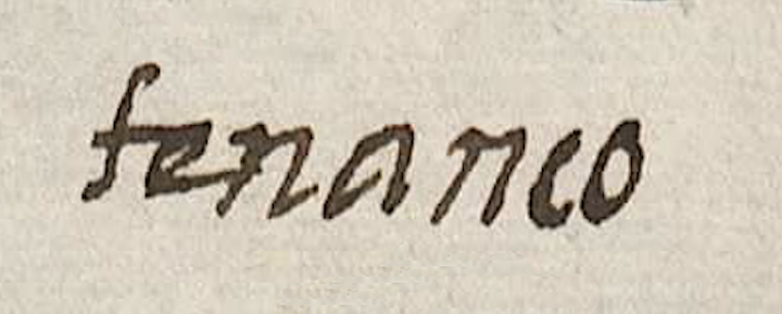
tenanco
Tenanco (today, Tenango)
Robert Haskett
1580
Robert Haskett
walls, ramparts, parapets, muros, murallas, rocks, stones, piedras, hills, mountains, cerros, nombres de lugares
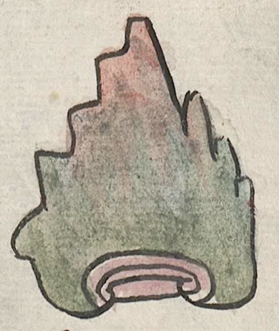
tenmi(tl), wall, rampart; a city wall, https://nahuatl.wired-humanities.org/content/tenamitl
tenan(tli), wall or rampart, https://nahuatl.wired-humanities.org/content/tenantli
te(tl), stone, rock, https://nahuatl.wired-humanities.org/content/tetl
-co, in, at (locative suffix; tells where), https://nahuatl.wired-humanities.org/content/co
el cerro del muro, el cerro de la muralla
Robert Haskett
Relación de Cempoala - University of Texas Libraries Collections. 1580-11-01. https://collections.lib.utexas.edu/catalog/utblac:f87917e2-e3c9-4eb2-a83...
Materials that are in the public domain (such as most of the maps in the PCL Map Collection) are not copyrighted, and no permission is needed to copy them. You may download them and use them as you wish. The image appears here courtesy of the University of Texas Libraries, The University of Texas at Austin. If you do publish anything from this database, please cite the Visual Lexicon of Aztec Hieroglyphs.