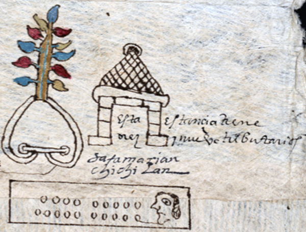
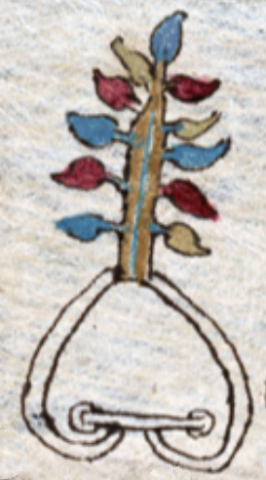
Chichillan (RGTyM17)
This is a painting of the compound glyph for the place name Chichillan ("The Red Place"). It has two elements. At the bottom is a black-line drawing of a simple hill or mountain (tepetl), which provides a semantic locative (in this case, -tlan). On top of the mountain is a large tree with a brown trunk, a thin blue line down the middle of this trunk, and eleven multi-colored (red, blue, and perhaps yellow) fruits or leaves attached directly to the trunk. These are probably meant to be chilli peppers.
Stephanie Wood
Barbara E. Mundy (The Mapping of New Spain, 1996, 147) also translates this toponym "Red Place."
Stephanie Wood
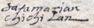
Sata marian
chichilan
Santa María Chichillan
Stephanie Wood
1582
Jeff Haskett-Wood
trees, árboles, quinine, quinina, pueblos, topónimos, nombres de lugares, place names
chichil(li), red, https://nahuatl.wired-humanities.org/content/chichilli
-tlan, place of or near, https://nahuatl.wired-humanities.org/content/tlan
chichic, something bitter, https://nahuatl.wired-humanities.org/content/chichic
chichiltic, something red, https://nahuatl.wired-humanities.org/content/chichiltic
Cerca del Árbol 'Chichicuahuitl'
Stephanie Wood
The source of these hieroglyphs is a manuscript and map known collectively as the “Relación de Tistla y Muchitlan,” also known as the “Descripción de la Alcaldia Mayor de las Minas de Zumpango.” Apparently, these towns (today spelled Tixtla and Mochitlan) are in the modern-day state of Guerrero, but they fell under the religious jurisdiction of the Diocese of Tlaxcala. Thanks go to Octavio Márquez for his contribution of the glyph, gloss, and contextualizing images.
The original manuscript is hosted on line as part of the Benson Latin American Collection, The General Libraries, University of Texas at Austin, https://collections.lib.utexas.edu/catalog/utblac:fbc92b3e-bb28-4258-975.... It is open-access.