Tepechichilco (TC RG)
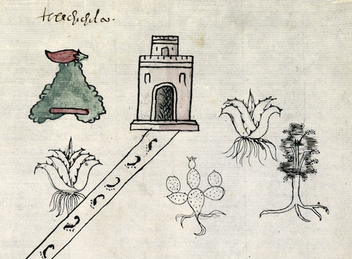
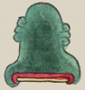
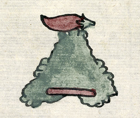
This is a compound glyph for the pueblo known as Tepechichilco (At the Red Hill). It appears on the 1580 Relación Geográfica de Telistaca (originally Tetl Iztacan, in the state of Hidalgo). The glyph, outlined in fairly thick black lines, consists of a hill or mountain (tepetl) surmounted by a red chile pepper (chilli) lying on its side, the stem pointing to the right. The logogram of the tepetl is a somewhat naturalized variation of the standard Nahua depiction of such landscape features, perhaps revealing a certain amount of Spanish cultural influence. The hill is shaded in green, with a red bar at its curling base, an approximation of older conventions of depicting tepetl. On the summit and along the sloping sides and base of the hill are tetl elements that are phonetic elements for the te- of tepetl. This latter part of the glyph also seems to serve as a semantic indicator of the unvoiced locative, -co, “in, at.” The logogram of the chile pepper provides the chil- part of the place name, as well as being a semantic indicator for the color red (chichiltic).
Robert Haskett
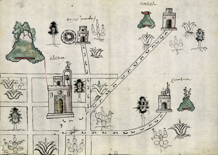
Tepechichilco was one of the subject communities of Tetl Iztacan, a cabecera (head town) in the vicinity of the better known Cempohuallan (Zempoala). The Spanish text of its Relación Geográfica states that its place name means “cerro bermejo” (“red hill/mountain;” folio 1 recto). It is possible that the red chile pepper of the glyph indicates the reduplication of chil that is found in the Nahuatl word for red, chichiltic; in other words, it is not only a logogram for a chile pepper, but also a red one. On the map, the glyph is paired with the frontal view of a black-outlined church with a large arched doorway, crenelations on its upper parts, and a squat square tower on its roof. It serves as a semantic indicator for an inhabited place, something characteristic of the RG map of Cempohuallan, as well. A black outlined road studded with human footprints issues from the doorway of the church and bears left at an angle, passing beautiful renditions of maguey plants, a nopal cactus, and a tree, all with exposed roots (see the historical contextualizing image). This road eventually connects Tepechichilco with the traza of Tetl Iztacan. Tepechichilco still exists, but is now a very small community which had only 39 inhabitants in 2020. For more information, see Mundy, Barbara E., “Mapping Babel: A Sixteenth-Century Indigenous Map from Mexico,” The Appendix, 1:4 (October 2013), and Mundy (1996).
Robert Haskett
tepechichilco
Tepechichilco
Robert Haskett
1581
Robert Haskett
colores, chiles, cerros, montañas, hills, mountains, red, rojo, bermejo, colorado, rocks, stones, piedras, nombres de lugares
This is the RG map of Telistaca. Source information is the same as above.
te(tl), stone, rock, https://nahuatl.wired-humanities.org/content/tetl
tepe(tl), hill, mountain, https://nahuatl.wired-humanities.org/content/tepetl
chichil(tic), red, https://nahuatl.wired-humanities.org/content/chichiltic
chil(li), chile pepper, https://nahuatl.wired-humanities.org/content/chilli
-co, in, at, https://nahuatl.wired-humanities.org/content/co
el cerro bermejo; el cerro rojo; el cerro colorado
Robert Haskett
Relación de Tetlistaca – University of Texas Libraries Collections, 1580-11-15. https://collections.lib.utexas.edu/catalog/utblac:d6867ccb-092b-47b1-87a...).
Materials that are in the public domain (such as most of the maps in the PCL Map Collection) are not copyrighted, and no permission is needed to copy them. You may download them and use them as you wish. The image appears here courtesy of the University of Texas Libraries, The University of Texas at Austin. If you do publish anything from this database, please cite the Visual Lexicon of Aztec Hieroglyphs.