Tetliztacan (TetlRG)
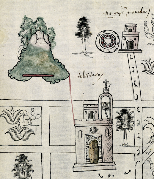
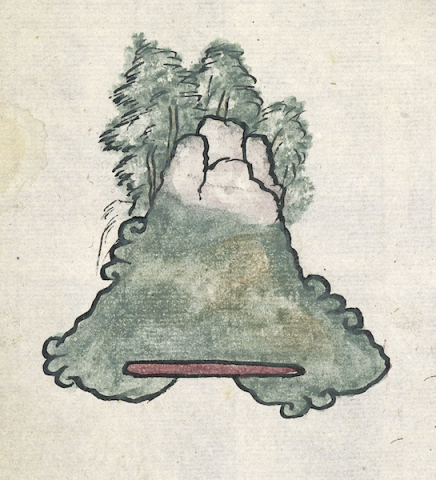
This is a compound glyph for the pueblo known as Tetliztacan [or Tetl Iztacan, which, based on the representation seen in the glyph, we would translate into English as “White Stone Hill.” It appears on the 1580 Relación Geográfica de Tetlistaca (Hidalgo). The hill itself is a variation of the standard Nahua depiction of such landscape features, perhaps revealing a certain amount of Spanish cultural influence. It is a somewhat naturalized tepetl) (hill, mountain) with a craggy, white summit that makes it look like a snow-capped hill. This latter element is a semantic indicator for the “white” (iztac) part of the hill’s (and thus community’s) name. The hill is shaded in green below this, with a red bar at its curling base, an approximation of older conventions of depicting tepetl. Along the sloping sides and base of the hill are the more original, curling tetl) elements that provide the first part of the hill and place name. The tepetl itself provides a semantic, unvoiced locative of sorts meaning “place of.” The fir-like trees rising from the summit do not seem to play a direct semantic role in the glyph, but must depict the kind of vegetation found there.
Robert Haskett
Tetliztacan (as normalized) is a cabecera (head town) in the vicinity of the better known Zempoala. As Barbara Mundy has noted, the RG map associated with the latter place intersperses communities and landscape features linked to Tetliztacan (as well as a third independent cabecera, Epazoyocan), a function of overlapping municipal jurisdictions. One of these shared features is the mountain of Tetl Iztac (or Teliztac as it is glossed on the present map, below), which gives the cabecera of Tetliztacan its name. The Spanish text of its Relación Geográfica states that the place name comes from the nearby “hill of white stone” (folio 1 recto). Indeed, on the Tetliztacan map there is a deliberate pairing of the hill with a church; they are connected by a red line. This magnificent church, in reality a Franciscan establishment, sits in the town center bounded by interesting roads, one of which has footprints seeming to indicate that people and perhaps clergy from a dependent community with a chapel and tianquiztli marketplace are under the authority of the cabecera’s religious authorities. The church itself is a powerful semantic indicator for the head town’s administrative and socio-political status. Foliage painted on the map glosses the magueys, nopal cacti, and trees that are common in the area (see historical contextualizing image). For more information, see Mundy, Barbara E., “Mapping Babel: A Sixteenth-Century Indigenous Map from Mexico,” The Appendix, 1:4 (October 2013), and the same author’s book, The Mapping of New Spain: Indigenous Cartography and the Maps of the Relaciones Geográficas (Chicago and London: The University of Chicago Press, 1996).
Robert Haskett
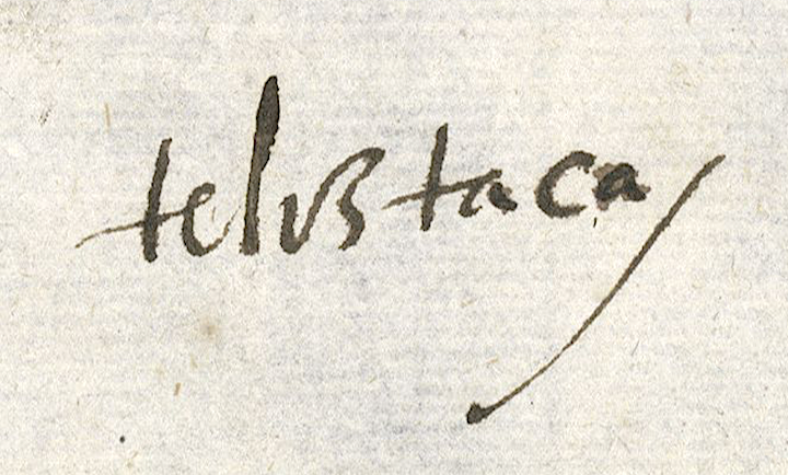
teliztaca
Tetliztacan or Tetl Iztacan
Robert Haskett
1580
Robert Haskett
hills, mountains, cerros, white, blanco, rocks, stones, piedras, nombres de lugares
te(tl), stone, rock, https://nahuatl.wired-humanities.org/content/tetl
iztac, white, something white, https://nahuatl.wired-humanities.org/content/iztac
tepe(tl), hill, mountain, https://nahuatl.wired-humanities.org/content/tepetl
-can, place of, https://nahuatl.wired-humanities.org/content/can-2
Relación de Tetlistaca – University of Texas Libraries Collections, 1580-11-15. https://collections.lib.utexas.edu/catalog/utblac:d6867ccb-092b-47b1-87a...).
Materials that are in the public domain (such as most of the maps in the PCL Map Collection) are not copyrighted, and no permission is needed to copy them. You may download them and use them as you wish. The image appears here courtesy of the University of Texas Libraries, The University of Texas at Austin. If you do publish anything from this database, please cite the Visual Lexicon of Aztec Hieroglyphs.