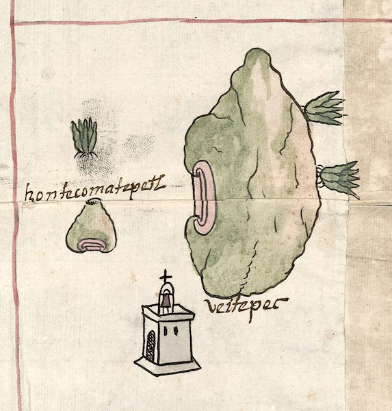
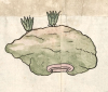
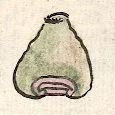
Tzontecomatepetl (CmpRG)
This is a complex glyph naming a landscape feature or perhaps a community called Tzontecomatepetl. It is featured in the 1580 Relación Geográfica de Cempoala (originally Cempohuallan, and now Zempoala, Hidalgo). The name is represented by a hieroglyph of a frontal view of a hill or mountain (tepetl) with a flat top, making it resemble a volcanic cone complete with its crater. Following the alphabetic gloss (see below), the place name consists of tzontecomatl), usually defined as “head, skull,” or “head cut off from the body,” and tepetl), hill, mountain. In this case, absent a head or skull associated with the glyph, it can be read as “hill with its top cut off,” or “flat-topped hill.” The hill also serves as a semantic indicator of “place.” The hill is outlined in black and filled in with tan and green. Its base shows a fairly typical element of three horizontal outlined bars, the upper one curling around the other two, colored in faded red.
Robert Haskett
There is a three-quarters drawing of a church near the Tzontecomatepetl glyph, but it could just as well refer to Hueitepec, another figure at this point on the map that was definitely a village in the area (see the historical contextualizing image). If the church, an element that usually serves as a semantic indicator of “inhabited place” on this map, was intended to be shared between the places, then Tzontecomatepetl could have been some kind of hamlet or village. But it is more likely that it is a landscape feature that was well known enough to be depicted here. Victor Manuel Ballesteros García (2005, pg. 64) seems to agree with that interpretation, but reports that in more recent times locals referred to the name as being related to a human skull or hair. But once again there is no indication of that on the map so that this could well be a reinterpretation of the name made a long time after the Relación was created. If the semi-naturalistic depiction of the hill is accurate, this landscape feature may have been a well-known dormant or extinct volcanic cone near to the community of Hueitepec, a sujeto (dependent town) of one of the four Cempohuallan cabeceras (head towns), Tzacuala. For more information about the RG map, see Biblioteca Digital Mexicana, A.C., http://bdmx.mx/documento/mapas-relaciones-geograficas-cempoala-epazoyuca... Mundy, Barbara E., “Mapping Babel: A Sixteenth-Century Indigenous Map from Mexico,” The Appendix, 1:4 (October 2013), and Mundy (1996).
Robert Haskett
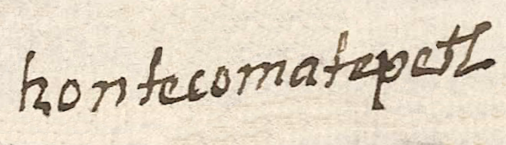
tzontecomatepetl
Tzontecomatepetl
Robert Hasektt
1580
Robert Haskett
heads, cabezas, skulls, los cráneos, las calaveras, hills, mountains, los cerros, nombres de lugares
tzontecoma(tl), skull, head, head cut off of a body, https://nahuatl.wired-humanities.org/content/tzontecomatl
tepe(tl), hill, mountain, https://nahuatl.wired-humanities.org/content/tepetl
la montaña que falta el pico (?)
Stephanie Wood
Relación de Cempoala - University of Texas Libraries Collections. 1580-11-01. https://collections.lib.utexas.edu/catalog/utblac:f87917e2-e3c9-4eb2-a83...
Materials that are in the public domain (such as most of the maps in the PCL Map Collection) are not copyrighted, and no permission is needed to copy them. You may download them and use them as you wish. The image appears here courtesy of the University of Texas Libraries, The University of Texas at Austin. If you do publish anything from this database, please cite the Visual Lexicon of Aztec Hieroglyphs.