Xalapan (CmpRG)
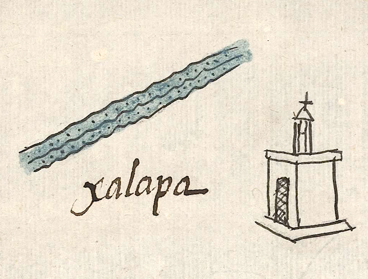
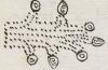
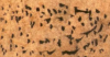
This is a compound glyph naming a community called Xalapan. It is featured in the 1580 Relación Geográfica de Cempoala (Zempoala, Hidalgo). The glyph appears at an angle on the map above an alphabetic gloss and near a church (see the historical contextualizing image). The place name is made up of the noun xalli (sand) and a canal or waterway (apantli). Alternately, the -apan could be a locative suffix ("on" or "at the water") phonetically indicated by the canal or waterway. The glyph itself depicts some kind of sandy canal or ditch, meaning something like “on the sandy canal.” It consists of three parallel, wavy black lines marking off spaces filled with black dots on fields of blue.
Robert Haskett
Typical of the map, the complex glyph for Xalapan appears near a church. With a few exceptions, the presence of a church serves as a semantic indicator for “inhabited place.” A more famous place, called Xallapan, is associated with Tollan (Tula) in the Historia Tolteca-Chichimeca.. For more information about the RG map, see Biblioteca Digital Mexicana, A.C., http://bdmx.mx/documento/mapas-relaciones-geograficas-cempoala-epazoyuca... Mundy, Barbara E., “Mapping Babel: A Sixteenth-Century Indigenous Map from Mexico,” The Appendix, 1:4 (October 2013), Mundy, 1996, and Ballesteros García, 2005, 64-65.
Robert Haskett
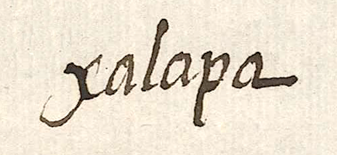
xalapa
Xalapan
Robert Haskett
1580
Robert Haskett
sands, sandy areas, arenales, arenas, Xallapan, Jalapa, nombres de lugares
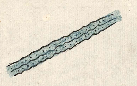
Xala(pan), a place name, one of the boundaries of the Nonohualca of Tollan (Tula), https://nahuatl.wired-humanities.org/content/xallapan
xalapan, sandy area, https://nahuatl.wired-humanities.org/content/xalpan
xal(li), sand, https://nahuatl.wired-humanities.org/content/xalli
-apan (locative suffix), on or at the waters of, https://nahuatl.wired-humanities.org/content/apan-0
apan(tli), a canal or water ditch, https://nahuatl.wired-humanities.org/content/apantli
el canal arenoso, la zanja arenosa
Robert Haskett
Relación de Cempoala - University of Texas Libraries Collections. 1580-11-01. https://collections.lib.utexas.edu/catalog/utblac:f87917e2-e3c9-4eb2-a83...
Materials that are in the public domain (such as most of the maps in the PCL Map Collection) are not copyrighted, and no permission is needed to copy them. You may download them and use them as you wish. The image appears here courtesy of the University of Texas Libraries, The University of Texas at Austin. If you do publish anything from this database, please cite the Visual Lexicon of Aztec Hieroglyphs.